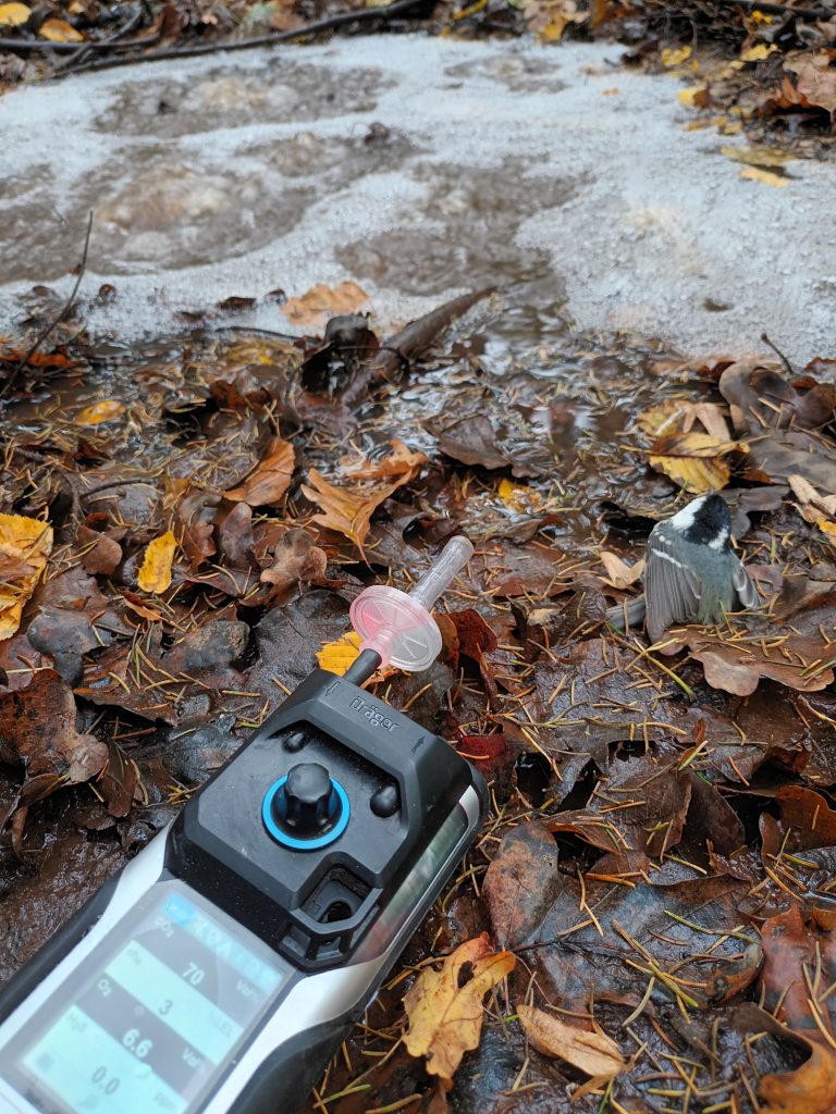
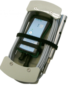
Instrument for Detection of Free Gases (CO₂, O₂, CH₄, H₂S): Dräger X am® 8000
Description of the equipment
The Dräger X-am® 8000 simultaneously measures four different ambient gases (CO₂, O₂, CH₄, H₂S) using diffusion and/or a pump. It is primarily intended for hazard detection, such as explosive or toxic gases, but is also used in soil and atmospheric research.
Technical Specifications
- Catalytic sensor (CatEx) for CH₄ measurements (0-100% LEL or 0-100 vol%)
- Electrochemical (EC) sensor for O₂ (0-25 vol%) and H₂S (0-200 ppm) measurements
- Infrared (IR) sensor for CO₂ (0-100 vol%)
- Maximum hose length up to 45 m
- Audible and visual alarms and vibration alert when limit values are exceeded
- Operating temperature range: -20 to 50 °C
- Inductive charging of Li-ion battery.
Applications / Projects / Publications
The gas detector at GeoZS serves two main purposes.
The first is safety-related detection of hazards due to the presence of explosive or toxic gases in specific working conditions: at boreholes and shafts for CO₂-rich mineral water abstraction, at thermal water wells containing methane, at hydrocarbon wells, and during pollution events or remediation of contaminants that may release these gases.
The second purpose is research-oriented, primarily for environmental measurements. It is used to determine the type and concentration of free gases in soil, gases released from groundwater, or present in the atmosphere. The instrument supports research on mineral water springs rich in free gases, natural CO₂ vents (mofettes), groundwater containing hydrogen sulphide (characterised by a "rotten egg" odour), and thermomineral waters containing hydrocarbons-particularly methane (CH₄).
Access to equipment
Field measurements are also conducted for external clients. The instrument can be rented, provided that prior user training is completed.
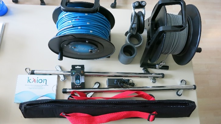
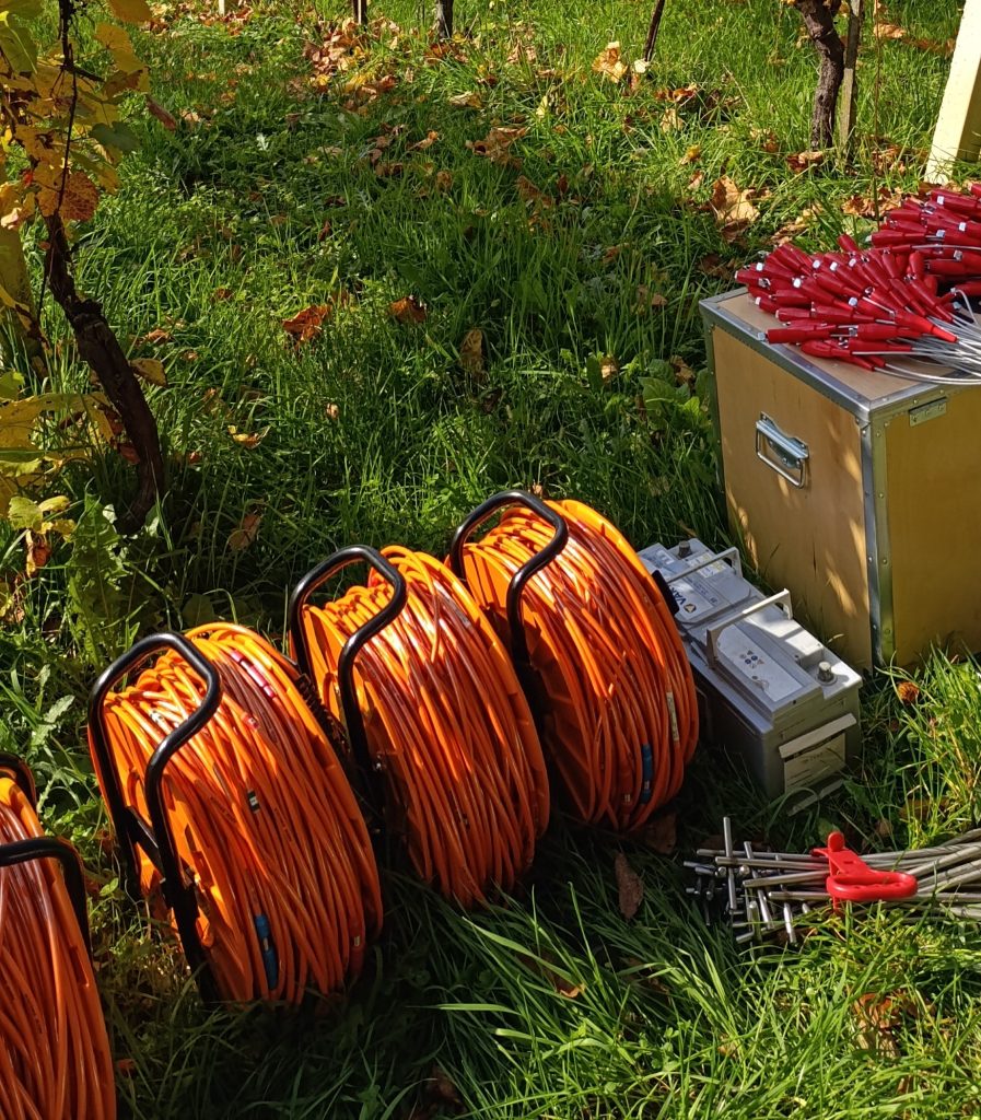
Equipment for measuring inclinations in boreholes
Description of the equipment
An inclinometer or clinometer is an instrument used for measuring angles of slope or tilt, elevation or depression of an object with respect to gravity direction. The equipment is intended for measuring displacements in boreholes up to a borehole length of up to 50 m. It enables the monitoring of movements in two directions, the speed of movements in landslides and the determination of the depth of the sliding surface.
The equipment consists of technical equipment and software for data processing:
- B.R.A. IN SYSTEM, 60m BLUE CABLE +-30°probe, BT remote
- PULLEY AND CABLE STOP
- DUMMY PROBE, 60 m CABLE Reel, 60 m cable
- KLION DATA ANALYSIS SOFTWARE For inclinometers and T-Rex
- Transport Masate-bag
Application
The equipment is used for engineering-geological research in which inclinations and displacements are measured in tubed boreholes for the purpose of base stability.
An inclinometer or clinometer is an instrument used for measuring angles of slope or tilt, elevation or depression of an object with respect to gravity direction. The inclinometer with attached probes is intended for measuring displacements in boreholes up to a borehole length of 50 m. It enables the monitoring of movements in two directions, the speed of movements on avalanches and the determination of the depth of the sliding surface. The B.R.A.IN (Borehole Readout Array for INclinometers) system is mainly composed by the BRAIN APP compatible with Android and iOS mobile operative systems, digital inclinometer probe (vertical and/or horizontal), and bluetooth reel with control cable. The electronic readout is integrated in the reel and the BLE (Bluetooth Low Energy) wireless protocol permits a fast and safe communication with the management device with a very low batteries' consumption.
The intuitive B.R.A.IN APP allows the user to manage the inclinometer and spiral meter surveys and immediatelly share the readings with the most popular APP installed on the device (i.e. email, Dropbox, Whatsapp, Google DRIVE, OneDrive, iCloud Drive etc.)
Survey could be then imported in KLION software for data analysis and export professional and customizable reports. The data processing software “KLION DATA ANALYSIS SOFTWARE for inclinometers and T-Rex” enables viewing and processing of the measured data of the speed and direction of movements in the borehole.
Access to equipment
Equipment is available for use to users outside GeoZS. However, the operation requires a trained team of operators and field assistants. Immediate access to equipment is possible at GeoZS when equipment is not in use. Price varies according to type of project, complexity of research, and field conditions.
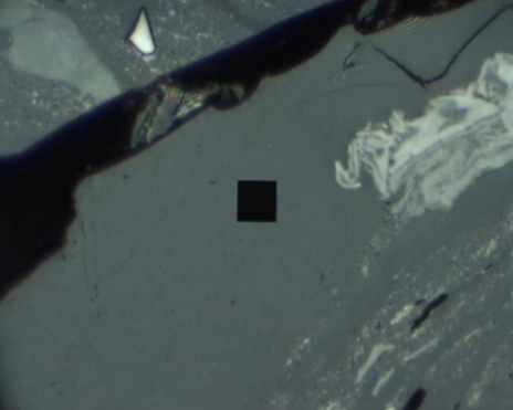
508 PV UV-Visible-NIR microscopy spectrophotometer with additions
Description of the equipment
The 508 PV UV-Visible-NIR microscopy spectrophotometer from CRAIC Technologies (USA) with accessories (standards, computer, software) is an add-on to the existing Zeiss-Opton Axiophot transmission, reflectance and fluorescence microscope. The equipment is intended for the study of organic matter (coals, kerogen, organic-rich rocks). The spectrophotometer is further used for the determination of fluorescent components in organic matter. These components include residues of algae, spores, pollen, cuticles, cork, resins and waxes. They are subordinate in coals and enriched in the organic matter of the source rocks for the formation of hydrocarbons, especially petroleum. They are collectively known as kerogen I and kerogen II. Rocks containing organic matter with kerogen I and/or II are abundant in the world, and are also known here in various stratigraphic units. They are black, formed in marine environments, and can be the carriers of various geochemical anomalies or even weathering. Some, also known in this country, are highly radioactive. Hydrocarbons are formed from the different types of kerogen only if the organic matter reaches a certain maturity range (oil from kerogen I and/or II in the Rr vitrinite range 0,5-1,35, gas from kerogen III in the Rr vitrinite range 0,9-3,0), which is measured by the method described in the first paragraph. The fluorescence intensity in the different colours (yellow, orange green, brown) is also measured and decreases with the maturity of the organic matter. The vitrinite reflectance method is further used in the study of the tectonically driven thermal history of sedimentary basins.
Access to equipment
The equipment is intended for use by GeoZS researchers and, by arrangement, by researchers from related institutions who are proficient in optical microscopy. The price is determined by the internal price list of the GeoZS or by agreement.
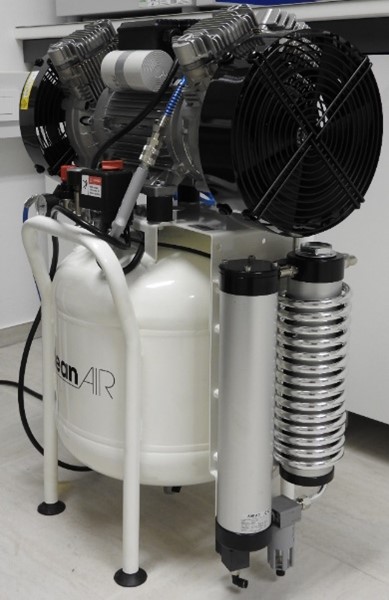
Oil-free dental compressor with air dryer
Description of equipment
The CleanAir CLR 25/50T compressor provides clean air (without condensation, oil vapors) with the help of an adsorption dryer and a water separator.
Technical data:
- pressure vessel volume: 50 l
- suction flow: 480 l/min
- effective flow: 240 l/min
Application
Compressor is intended for blowing samples for SEM/EDS analyses and cleaning parts of the SEM microscope when changing the cathode.
Access to equipment
The device is not intended for rent to external clients because it is used for routine laboratory work at GeoZS.
Digital optical microscope (Keyence)
Description of the equipment
The Keyence VHX-7000 high-accuracy digital microscope with fully integrated head and sample analysis and measurement software is an optical microscope with a large depth of field and advanced measurement functions.
The microscope is equipped with a high-resolution camera with a 4K CMOS sensor in an integrated head, which allows tilting of the observation axis and rotation around the object for a full 360-degree view in 2D as well as 3D. It features a wide range of magnifications; optical magnification from 20 to 500x and digital magnification up to 2500x (4x digital zoom). The microscope can be used for observation in reflected light, transmitted light, polarised light and dark field.
The equipment features large depth of field, advanced measurement functions, user friendly interface and state-of-the-art technology for sample analysis and 2D and 3D measurements, which can be performed on-screen in real time. Features include measurement of point-to-point distances, angles, diameters, parallels and areas using the automatic edge detection function. Automatic analytics include grain counting, grain size analysis and ISO surface contamination analysis.
Technical data:
- Camera with high-resolution 4K CMOS image sensor: 1/1.7 inch, 12.22 megapixels, maximum 4168 (H) × 3062 (W) pixels, HDR, maximum frame rate 30 fps, electronic shutter release from 1/60 s to 1/19,000, JPEG and TIFF image formats;
- Light source: high-intensity LED lamp;
- VHX-S750E free-rotating observation system with XYZ motorised stage and VGA side camera: integrated head mount with 180° Z-axis tilt, 171 mm x 168 mm table, 40 mm X-, Y- and 50 mm Z-axis range, Z-axis autofocus;
- High-resolution VH lenses: VHX-E20 (20-100x magnification), VHX-E100 (100-500x magnification), VHX-E500 (500-2500x magnification);
- Coaxial polarising filter set OP-88323;
- OP-88139 rotatable cross polarizer;
- 27-inch colour LCD monitor, 3840 (H) × 2160 (W) pixels;
- 1 TB hard disk drive unit with memory and software;
- VHX-H5M software for 3D measurements.
Application
The high-resolution digital microscope with movable head and software for sample analysis and measurement has large depth of field and advanced measuring functions. It offers a full 360-degree view in both 2D and 3D modes. It has a wide range of magnifications; optical zoom is 20x to 500x and digital zoom is up to 2,500x. It is useful for petrographic, sedimentological, and palaeontological studies in transmitted and reflected light. It is also suitable for analysis of environmental media, archaeological artefacts and other materials.
The digital optical microscope is useful for petrographic, sedimentological and palaeontological investigations. It is also useful for the analysis of environmental media, archaeological artefacts and other materials. The fast automatic 2D or 3D image stitching function allows the scanning of petrographic thin-sections and large samples.
Examples of applications: petrographic investigations in polarised transmitted light, sedimentological and micropalaeontological investigations in transmitted light, and reflective light investigations in 2D and 3D with easy generation of reports.
Access to equipment
Analyses for external clients are performed by trained and experienced GeoZS operators upon prior agreement and at times agreed with the person responsible for the equipment.
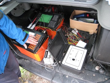
DMT Summit X One equipment for seismic geophysical surveying
Description of the equipment
The DMT Summit X One is an advanced modular set of field equipment for seismic surveys. It allows efficient field surveys to be carried out with a minimum of field logistics. The basis is the DMT Summit X One ‘remote unit’, which digitises the signal from each geophone and sends it to a data acquisition unit and on to a laptop, where data quality control and storage is performed. The maximum number of active channels in the current configuration is 72, while the normal number is 60, with 12 mobile units and operation in roll-along mode. Measurements are performed with 40 Hz geophones.
Two seismic sources are available: the accelerated weight drop GISCO ESS.100 and a hammer with a piezoelectric switch.
Technical specifications:
72x DMT Summit X One remote units;
2x Summit X One data acquisition units;
1x Summit X One triggering unit;
2x power cables;
1x trigger cable with extension (250 m);
3x DMT 330 m data cables;
75x 40 Hz geophones (KCL-4 connector);
field laptop with Summit X One data acquisition and quality control software;
seismic source: hammer with piezoelectric switch.
Applications/projects/publications
Research groups Dynamic Earth, Regional Geology, Mineral Resources, and Groundwater and Geochemistry; various research and commercial projects.
The equipment is used for high-resolution reflection seismics and is suitable for shallow structural-geological investigations using P-waves, with a depth range between 15 m and 300 m in:
structural geology, active tectonics (structure of Quaternary, Plio-Quaternary, and Neogene sediments, including faults and folds),
hydrogeology (structures of Quaternary and Plio-Quaternary intergranular aquifers),
mineral resources (primarily for quartz sand exploitation).
Access to equipment
Analyses for external clients are performed by trained and experienced GeoZS operators upon prior agreement and at times agreed with the person responsible for the equipment.
Equipment for high resolution seismic surveying
Description of equipment
Determination of shallow to moderately deep subsurface geological structures, determination of presence of structural elements (faults, folds, ...), orientation of bedding and structure of aquifers. Determination of shallow to moderately deep subsurface geological structures, determination of presence of structural elements (faults, folds, ...), orientation of bedding and structure of aquifers. Application for structural interpretation in structural geology, determination of aquifer geometry and engineering geological purposes.
Application
ARRS Programme Group, ARSO - Production of seismotectonic maps, various market projects.
Access to equipment
Equipment is available for use to users outside GeoZS. However, the operation requires a trained team of operators and field assistants. Immediate access to equipment is possible at GeoZS when equipment is not in use. Price varies according to type of project, complexity of research, and field conditions.
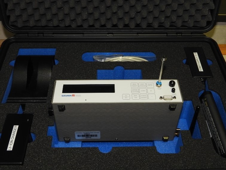
Portable laser aerosol spectrometer GRIMM 11-D with housing and weather station Lufft WS500-UMB
Description of equipment
The entire system consists of a laser aerosol spectrometer (GRIMM 11-D), a protective housing for protection against various weather conditions, and a weather station (Lufft WS500-UMB). The system enables on-line measurements of particle number concentrations, mass concentrations (PM10, PM2.5, PM1), the total mass of airborne particles in indoor and outdoor spaces and inhalable, respiratory and alveolar fraction including air temperature, relative humidity, pressure, wind direction and speed.
Technical data:
- aerosol volume flow: 1.2 l/min
- particle size range: 0.25 - 32 µm (31 channels)
- max. particle concentration: 2,000,000 particles/l (100 mg/m3)
- reproducibility: ± 3%
- data saving interval: 1 s - 60 s
- particle sampling: 47 mm PTFE filter with 1.2 µm pores
Application
We use the aerosol spectrometer to measure and sample airborne particles during episodes of desert dust with the aim of determining the origin of the dust, measuring particle concentrations in city buses, and measuring and sampling airborne particles in tourist caves and polluted environments.
Access to equipment
Measurements for external customers are performed by trained and experienced GeoZS operators upon prior agreement and at times agreed with the person responsible for the equipment. The price depends on complexity of the research and field conditions (weather, location of measurements-indoor or outdoor areas...).
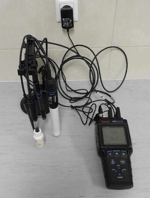
Portable multi-channel multimeter - Orion Star A329 (pH/EC/ORP/DO/ISE (Pb, Ag, S))
Description of equipment
The Orion Star A329 multimeter is equipped with pH electrodes (classic and flat for measurements in microvolumes), EC electrode, ORP electrode, RDO electrode and ISE electrodes for determining Pb (0.2 - 20,700 ppm) and Ag/S (0.01 - 107,900 ppm Ag; 0.003 - 32,100 ppm S).
Application
The portable multimeter is used for routine measurements of pH, EC, ORP, DO and Pb, Ag, S concentrations in surface and underground water, precipitation, mine waters and leachate, as well as measurements of these parameters in sediments and soils in areas burdened with heavy metals.
Access to equipment
The device is primarily intended for measurements as part of the scientific-research work at GeoZS. Experienced GeoZS operators can also perform measurements for external clients upon prior agreement and at times agreed with the person responsible for the equipment.
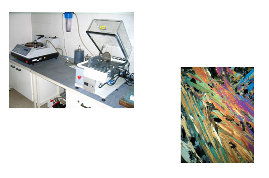
Trimming, lapping and polishing system, Logitech
Description of equipment
The Logitech Geological trimming, lapping and Polishing System (Logitech) is used for cutting, fine grinding and polishing of all types of geological materials. We produce standard slides for petrographic, sedimentological and palaeontological studies, as well as polished slides for optical and electron microscopy studies.
Application
The system is used for trimming with vacuum chuckface for glass slides, grinding and final lapping of thinsections.
Access to equipment
Access to equipment via contact person. For hire only by experienced users or by prior arrangement with the equipment administrator
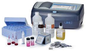
DR1900 Portable Spectrophotometer for field measurements of chemical composition of water
Description of equipment
The measurements of iron and manganese content in water can be measure using a portable spectrophotometer, the HACH DR1900. For Fe²⁺ (iron) measurements, the Ferrover Accuvac reagent needs to be used, with a detection range of 0.02-3.00 mg/L Fe²⁺. For manganese measurements, the Powder Pillow reagent (Peridate Oxidation Method) needs to be used, with a detection range of 0.1-20 mg/L. The water sample is measured by first preparing a blank sample, followed by a sample with the reagent.
Access to equipment
Instrument is not accessable directly. It is required advance knowledge of handling the instrument. If there is an interest in analysing water samples, you need to contact the laboratory stuff.
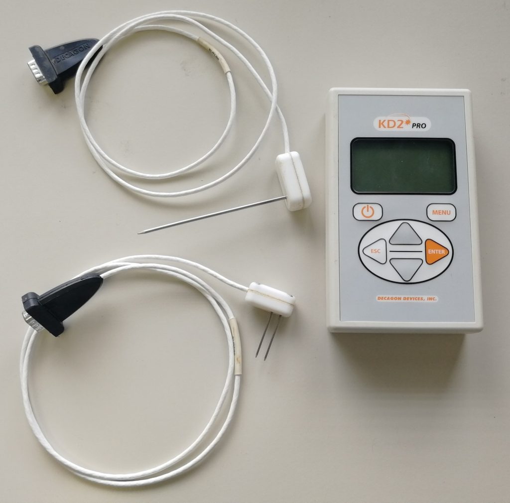
KD2 Pro Thermal Properties Analyzer
Description of equipment
Technical data:
-
Manufacturer Decagon Devices, Inc.
-
measuring sensors KS-1, TR-1, SH-1 and RK-1
-
measured properties: depending on the sensor used - thermal conductivity (λ), thermal diffusivity (α), thermal resistance (R) and volumetric specific heat (c)
-
measuring range: depending on the sensor used - thermal conductivity: 0,02 to 6,0 W/(m∙K), thermal resistance: 17 to 5000 °C∙cm/W, thermal diffusivity: 0,1 to 1,0 mm2/s and volumetric specific heat: 0,5 to 4,0 MJ/(m3∙K)
-
precision and accuracy of results: from 5 - 10 % (depending on the probe used)
-
measurement speed and duration: a measurement for one sample takes 15 min
-
sample size: in general, the device is field-ready, so no pre-preparation is needed. For measurements in the laboratory, the sample must be prepared in the form of a cylinder with dimensions of at least 5 × 10 cm.
Use/projects/articles
The meter is suitable for unbound sediments and can also be used on solid rocks with the KD2 Pro RK-1 Rock Sensor package.
Equipment rental
We also carry out measurements for external clients on samples in the GeoZS laboratory or in the field.
Geoelectrical measurement system
Description of equipment
The ABEM Terrameter LS 2 is an elecrical data acquisition system for self-potential (SP), dc-resistivity, and time-domain induced polarization (IP) measurements. It is ideal for geotechnical, groundwater, mineral, environmental surveys, etc.
Access to equipment
Analyses for external clients are performed by trained and experienced GeoZS operators upon prior agreement and at times agreed with the person responsible for the equipment.
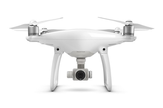
Drone
Application
Drone
Some possible applications:
- Change monitoring (comparisons of the situation before and after storms, landslides, glacier dynamics, erosion monitoring, etc.),
- terrain modelling (volcanic craters, glacial features, river banks, geomorphology, cliffs, beaches, outcrops, etc.),
- rivers and flood assessment (aerial flood damage assessment, river mapping and modelling, flood protection planning, river surveys, etc.),
- farmland management and analysis (irrigation systems, spraying planning, vegetation analysis, identification of arid areas, etc.).
Access to equipment
The equipment is not for hire to external users.
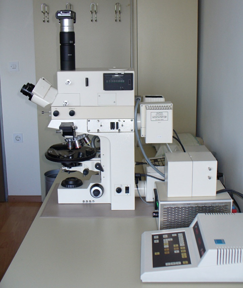
Opton Zeiss microscope for transmitted and reflected light, fluorescence and photography
Description of equipment
The Opton Zeiss microscope is the youngest and probably technically the best optical microscope at GeoZS, although it is already 30 years old. It is designed for optical microscopy in transmitted and reflected light in air. It is the only microscope that offers research in reflected light. It therefore allows micropetrographic examination of rocks in clasts in normal transmitted light, as well as of ore and coal clasts (or organic matter) in normal reflected light. Using a UV filter and an Hg lamp, it allows the fluorescence of organic matter and fluorescent minerals to be investigated. Equipped with a light stabiliser, a camera and a command unit for focusing the image and for adjusting the photographic settings. The eyepieces (10 × magnification) are permanently mounted. The lenses can be interchanged at magnifications of 5 ×, 10 ×, 20 ×, 25 ×, 50 ×. The maximum magnification that can be achieved with very well polished surfaces is therefore 500 ×, but in practice the most commonly used magnifications are 100 ×, 200 × and 250 ×.
The Opton Zeiss microscope has been used for a number of investigations of our coal samples, mainly in Zasavje, Velenje and Kanižarice, and for investigations of sedimentary clastic rocks, while investigations of igneous, metamorphic and carbonate rocks have been carried out mainly on other microscopes at the GeoZS, but can also be carried out on this microscope. However, it cannot be used to investigate the maturity of organic matter, which is one of the basic methods for investigating organic matter.
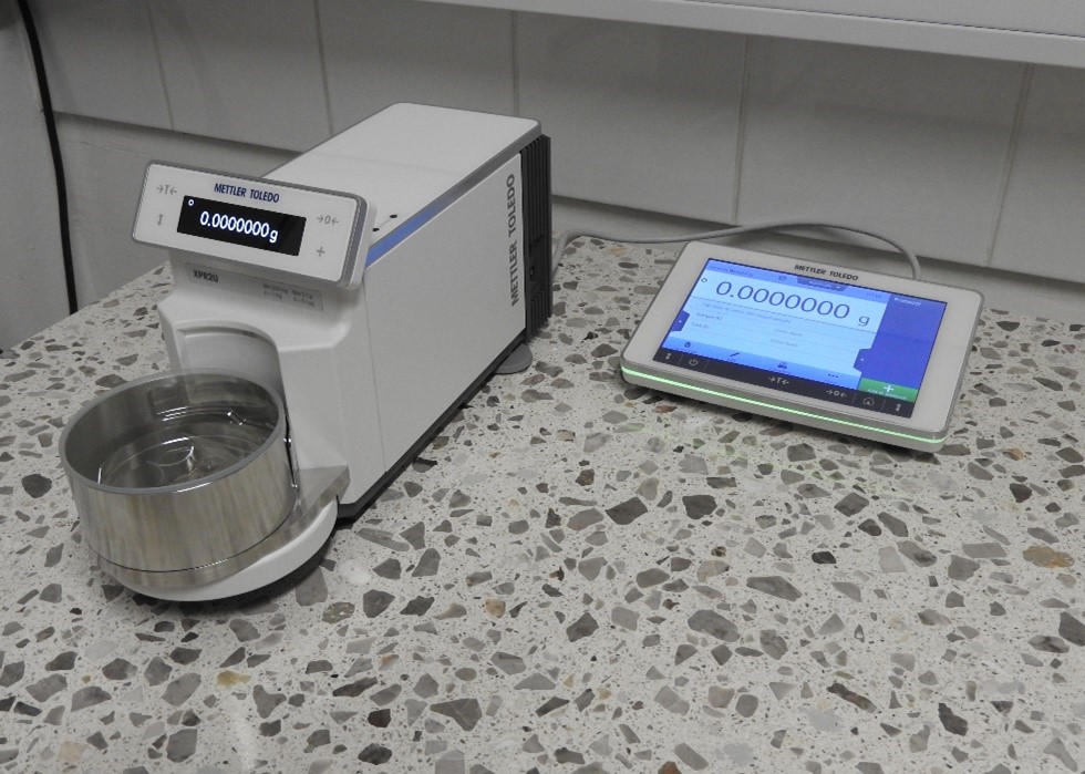
Ultra micro-balance - Mettler Toledo XPR2UM
Description of equipment
The ultra micro-balance Mettler Toledo XPR2UM is type-approved and, in addition to the classic weighing chamber with a weighing plate with a diameter of 16 mm, is also equipped with a set for weighing filters with a diameter of 47 - 70 mm.
Technical data:
- maximum capacity (weighing range-max.): 2.1 g
- readability: 0.1 µg
- repeatability: 0.15 µg
- guaranteed reproducibility: 0.2 µg
- min. weight (USP, U=0.1%, typical): 0.3 mg
- readability (certified): 1 mg
- calibration: built-in/advanced proFact
Application
The ultra micro-balance is used for weighing filters within the scope of measurements of airborne particles (determination of gravimetric factor), heavy-liquid separation of minerals, sieving of the particle fraction <10 µm and other applications where extremely precise accurate weighing up to a maximum of 2g is required.
Access to equipment
Weighing for external clients are performed by trained and experienced GeoZS operators upon prior agreement and at times agreed with the person responsible for the equipment.
Geophysical borehole logging equipment
Description of the equipment
The carotation equipment is used to measure geophysical parameters in boreholes of interest to hydrogeology, structural and engineering geology, geothermal (hydrogeothermal) and geotechnics.
Application
Well logging equipment is used for performing well measurements important for hydrogeology: fluid temperature and el. conductivity, gamma activity, short and long normal resistivity, spatial potential and single point resistivity. With well logging equipment the changes in borehole could be measured (water flow, lithological changes, caverns). With our own founds the caliper probe, flowmeter, probe for borehole geometry measurements (inclination and azimuth) and submersible video camera were bought. Submersible video camera for borehole inspection shows realistic picture of well condition: harms, casing, caverns...
Access to equipment
Well logging is specific field research equipment, mounted on the field vehicle, used for performing well measurements. The usage of the equipment is possible only with operative experts. The costs of call-up for field day with performing measurements includes 8 hours with two probes, each next measurement with other probe is calculated per hourly rate. Access to equipment via contact person.
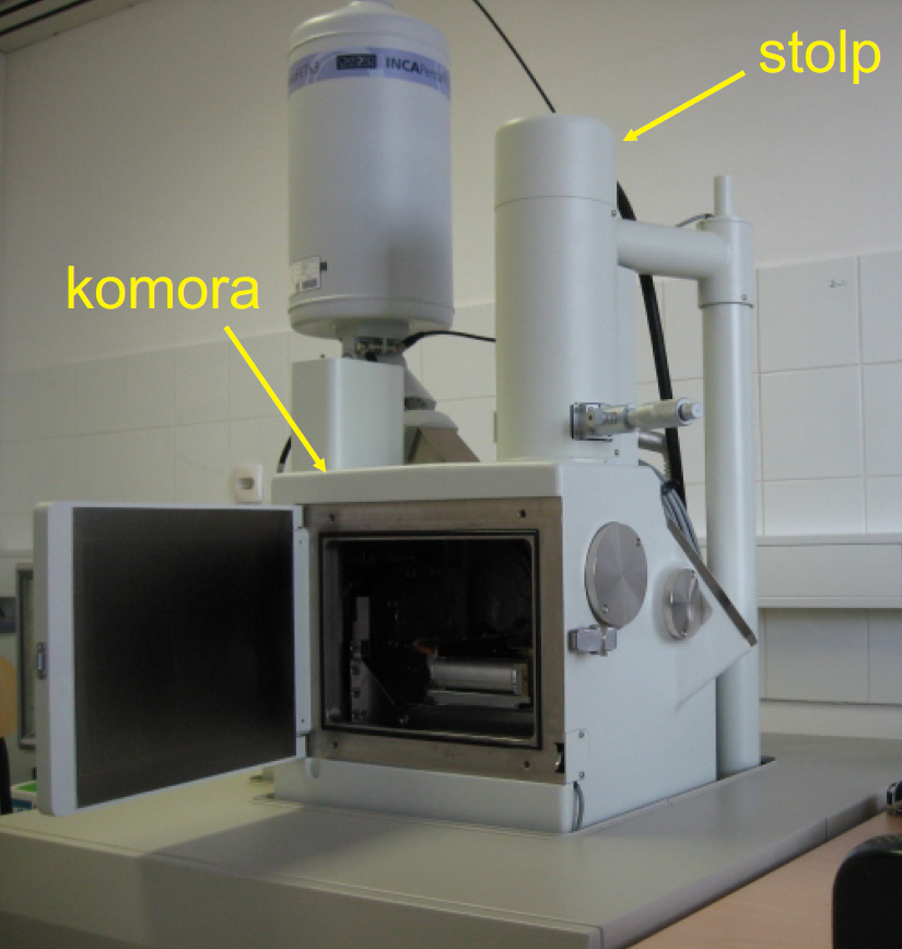
Scanning electron microscope with energy dispersive spectrometer (SEM/EDS) - JEOL JSM 6490LV
Description of the equipment
The entire system consists of:
- SEM (JEOL JSM 6490LV): sample vacuum chamber, column with electron source tower (W cathode), electromagnetic lenses and deflection coils and signal detectors (SE, BSE)
- EDS (INCA PentaFETx3 detector and INCA Energy 350 microanalysis system)
- Baltec SCD 050 sample preparation system
Principle of SEM/EDS operation:
The interaction of a focused beam of electrons moving across the sample with the atoms in the sample produces different signals, such as secondary electrons (SE), backscattered electrons (BSE) and X-rays, which provide different information about the sample:
- SE give an image of sample surface
- BSEs depend on atomic number of elements in the sample and give image of relative chemical composition of the sample.
- X-rays provide information on the elemental composition of the sample.
The Baltec SCD 050 system is intended for preparation of samples before analysis employing gold sputtering and carbon evaporation
Technical data:
- resolution: high vacuum: 3.0 nm (30 kV), 8.0 nm (3 kV), 15 nm (1 kV); low vacuum: 4.0 nm (30 kV)
- magnification: ×5 - ×300,000
- acceleration voltage: 0.3 kV - 30 kV
- sample table movement: X: 125 mm, Y: 100 mm, Z: 5 mm - 80 mm, tilt: -10° - +90°, rotation: 360°
- pressure in low vacuum mode: 1 - 270 Pa
- EDS detector: Si(Li), 30 mm2 detector area, resolution 133 eV at MnKa, ultra-thin polymer window (ATW2) detector
Application
SEM/EDS is used for non-destructive observation of surface morphology and determination of qualitative and semi-quantitative elemental composition of solid materials
We use SEM/EDS at the Geological Survey of Slovenia in various fields of geology as well as for other applications:
- Paleontological investigations
- Sedimentary and petrological investigations
- Coal investigations
- Mineralogical investigations of materials
- Geochemical research of environmental media
- Other applications: analyses of synthetic fibers, archaeological artefacts
Access to equipment
Imaging and measurements on SEM/EDS are performed by trained and experienced GeoZS operators upon prior agreement with the person responsible for the equipment also for external clients and with cooperation with users of services
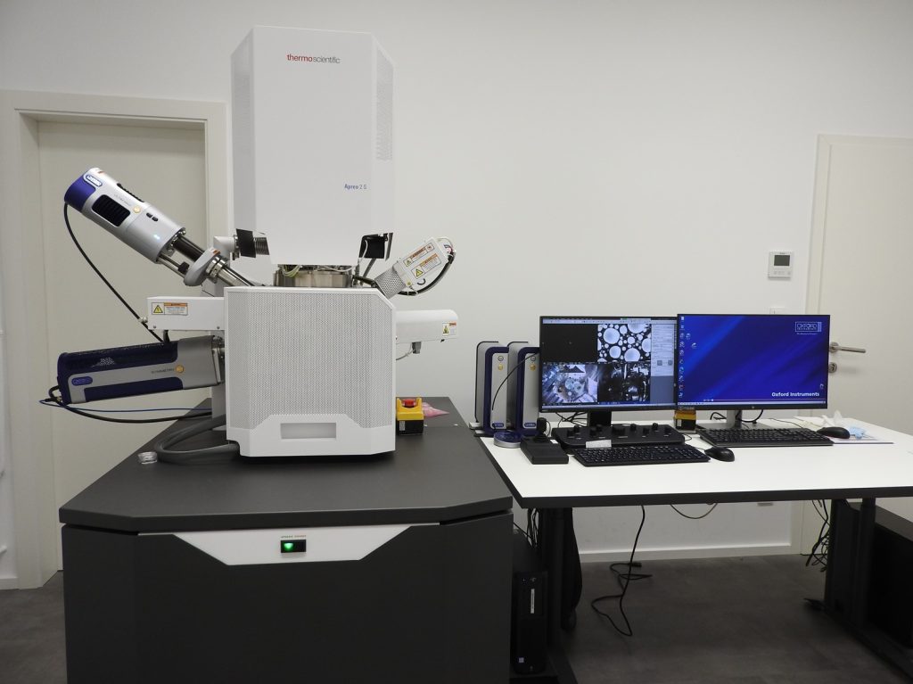
Field emission scanning electron microscope (FE-SEM) with low-vacuum mode, energy dispersive spectrometer (EDS), electron backscatter diffraction (EBSD) and cathodoluminescence (CL) - ThermoFisher Apreo 2S LoVac
Description of the equipment
Field emission electron microscope (FE-SEM) with ultra-high resolution enables observation of the surface of solid, well-bonded and non friable materials at sub-nanometer level.
The SDD energy dispersive spectrometer (EDS) with improved energy resolution enables the quantification of light elements and determination of composition of materials at submicron level, as well as separation between elements whose characteristic X-ray energies are very close to each other.
Electron Backscatter Diffraction (EBSD) detects diffracted backscattered electrons (BSE) on the crystal planes of the sample and forms a diffraction pattern characteristic of the crystal structure and orientation of the sample, which provides information on mineral phases, crystal grain orientation, defects in crystal grains, boundaries between grains and homogeneity of the sample at submicron level.
Cathodoluminescence (CL) detects EM waves in the visible spectrum and forms an image of all elements or features in a material that cause the emission of EM waves. This gives us insight into the distribution of trace elements in minerals and phases, which depends on various processes, growth of minerals and phases, zonation, cementation, etc.
Technical data:
1. FE-SEM (ThermoFisher Apreo 2S with Schottky thermal field emission electron source):
- accelerating voltage: 0.2 - 30 kV;
- electron beam current: 1 pA - 50 nA;
- resolution: at 15 kV = 0.5 nm (BD); at 1 kV = 0.8 (BD); at 15 kV (30 Pa) = 1.2 nm;
- magnification: 10× - 1,000,000×;
- stage (movement X = Y = 110 mm, Z = 65 mm, T = -15 to +90°, R = 360°);
- variable pressure (10 - 500 Pa);
- 2 in-lens detectors (SE, BSE);
- 1 in-column detector (SE);
- E-T SE detector;
- SE detector for observation in LV mode;
- segmented BSE detector.
2. Dry SDD EDS (Oxford UltimMax 65, AZtecLive Automated):
- active surface 65 mm2;
- resolution better than 125 eV at Mn Ka and 50,000 cps.
3. EBSD (Oxford AZtec HKL Symmetry S2 Advanced):
- captured image resolution 1244 x 1024 pixels;
- indexing speed >4000 pps;
- 5 integrated detectors of forward scattered electrons (FSD detector) for orientation and phase Z-contrast.
4. CL detector (ThermoFisher):
- RGB, wavelength: 350 nm - 900 nm.
Application
FE-SEM/EDS/EBSD/CL is used for in-depth and special research, which includes more detailed analyses of surface micromorphology of solid and well-bonded materials, chemical composition and microstructures of various carriers of geological and geochemical information at submicron level, and identification of polymorphic minerals and phases in various geological and environmental media. The information obtained with this system contributes to understanding of natural and anthropogenic processes in the environment.
Used within Programme groups and projects:
- P1-0025 Mineral resources,
- P1-0020 Groundwater and geochemistry,
- P1-0011 Regional geology,
- J1-1713 Dynamics and matter flow of potentially toxic elements (PTEs) in urban environment.
Access to equipment
Analyses for external clients are performed by trained and experienced GeoZS operators upon prior agreement and at times agreed with the person responsible for the equipment.
Laser particle sizer and dynamic image analysis system
Description of equipment
The laser particle sizer and dynamic image analysis system allows particle sizing either by laser diffraction or by image-based particle shape and size analysis. The laser method allows the measurement of particles from 0.01 to 3800 μm in a suspension of water or air. The dynamic image analysis method allows the measurement of particles in a suspension of water in the range 5 μm - 3 mm and in a suspension of air in the range 20 μm - 20 mm.
Access to equipment
Analyses for external clients are performed by trained and experienced GeoZS operators upon prior agreement and at times agreed with the person responsible for the equipment.
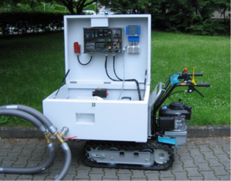
Thermal Response Test
Description of equipment
Manufacturer: UBeG GmbH & Co. KG, Germany
The Thermal Response Test (TRT) apparatus allows for the measurement of the thermal response between a vertical heat exchanger (geoprobe) and the surrounding rock. This allows us to directly determine the effective thermal conductivity of the area under investigation and enable the correct sizing of the planned closed-loop geothermal system.
The primary benefit of this method is that it directly obtains thermal conductivity values along the entire borehole, taking into account local hydrogeological factors (presence of groundwater) and the physical properties of the surrounding sediment or rock (mineral composition, porosity, saturation, density, grain size). This allows for the capture of data that may differ significantly from values obtained in the laboratory or in the field with a needle probe. This is due to the fact that the measurements are performed on a smaller sample, which consequently does not capture all important factors.
Following the German VDI standard (4640, Blatt 5) and the Guidelines for shallow geothermal drilling up to a 300m depth (Prestor et al., 2021), the TRT is recommended for devices where a power greater than 30 kW is planned, or if a larger field of geoprobes is planned.
Application
The TRT is intended for use in geothermal research, where the objective is to determine the basic thermal parameters of the subsurface.
The thermal response test is performed on an already installed research geoprobe. According to the VDI standard and Slovenian Guidelines (2021), for larger geoprobe fields (> 30kW, > 3 geoprobes), it is recommended to perform field measurements with a TRT.
Access to equipment
It is possible to rent a service with operators.
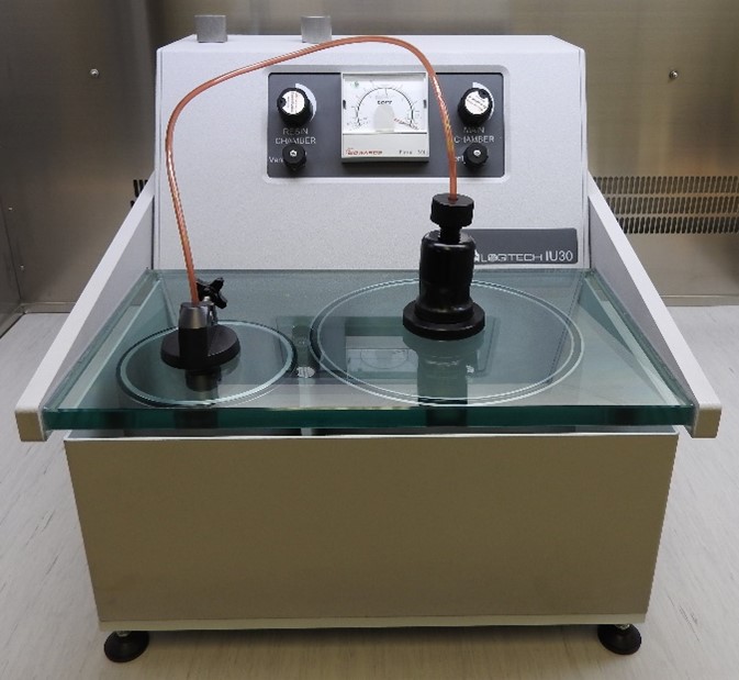
System for vacuum impregnation of friable and porous samples with resins - Logitech IU30
Description of equipment
The Logitech IU30 system consists of a vacuum pump and two vacuum chambers that enable separate vacuuming (degassing) of the sample and the impregnation resin (epoxy). This removes gases from the sample and the resin, which in classical impregnation hinder flow of the resin into the interior of the sample and prevent the grains from binding with the resin or even destroy the structure of the sample. Before impregnation itself, a special sample preparation (dehydration) is required, which usually involves replacing the water in the sample with acetone or lyophilization. Technical data:
- max. achieved vacuum: 10-2 mbar
- separate evacuation (outgassing) of resin and samples
- resin outgassing vacuum: 2 x 10⁻¹ mbar
- sample outgassing vacuum: 5 x 10⁻² mbar
- max. sample size: 150 x 100 x 120 mm
Application
The system is used for impregnation of friable and porous geological materials (sandstones, claystones, siltstones, sediments, soils, coals, etc.) and other materials (concretes and cements) with synthetic resins under vacuum. It is particularly suitable for the preparation of samples in which structures and textures must also be preserved.
Access to equipment
Trained and experienced GeoZS operators also perform impregnation of samples for external customers upon prior agreement and at times agreed with the person responsible for the equipment. The price of sample impregnation depends on the type of material and the complexity of the samples.
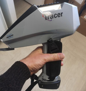
Portable X-ray fluorescence analyser
Description of equipment
The Handheld and Portable X-ray Fluorescence (XRF) Analyser is a high-performance device for analysing elements using high-energy X-ray radiation. The handheld XRF analyser contains a detector to detect X-ray fluorescence and determines the chemical composition of each element based on the energy of the beam. The analytical method can be used to determine the qualitative, semi-quantitative and quantitative composition of 48 major and trace elements in a variety of materials in a rapid, reliable and non-destructive manner.
Application
Mineral Resources, Groundwater and Geochemistry, Regional Geology and Dynamic Earth programme groups, various research and market projects.
Access to equipment
Measurements can be made on rock, sediment or core samples in the field or in the laboratory (using a benchtop stand with protective fittings).
Water pumps
Description of equipment
Pumps are used for pumping water from various objects (boreholes, wells, etc.). They are submersible and pressurised, of different dimensions and power, thus ensuring the right selection according to the characteristics of the well/borehole and the desired water flow.
Access to equipment
The equipment is not for rental as it is used for routine laboratory work at GeoZS.
Portable Turbidity Meter Hanna - HI98703
Description of the equipment
The turbidity using a portable turbidity meter HANNA- HI98703 (accuracy: ±2% of readings, ±0.02 NTU), is measuring twice after at least three volumes of water is pumped (with submerible pump - if well) or in the mittle of the stream flow (if river, stream). Before performing the measurements, the turbidity needs to be approximately estimated visually using four provided primary standards with specified turbidities (<0.1 NTU, 15 NTU, 100 NTU, and 750 NTU). Based on this qualitative turbidity estimation, the “zero sample” needs to be measured first. Zero sample is one of the primary standards with a specified turbidity. This step also determined the measurement accuracy and any potential deviations. Subsequently, the turbidity of the water sample needs to be measured (at least three times for the same sample to ensure measurement repeatability).
Application
Field measurements of turbidity in water - in caase of cleaning wells or pumping tests.
Access to equipment
Instrument is possible to rent. Before the rent it is necessary to no the basic setings. It is necessary to contact laboratory stuff.
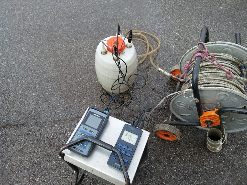
Flow meter
Description of equipment
- Tracer System TQ-S manufactured by Sommer Messtechnik;
- the flow quantity of water is measured with salt;
- range: up to a flow rate of 10 m3/s;
- measurement based on conductivity (0 ... 5000 μS/cm).
Application
It is used for measuerments of flow in spings, streams and rivers.
With the instrument, we can measure the flows of various water bodies, which helps us to compile a complete picture of the water balance in specific areas.
Serianz, L., Cerar, S., & Vreča, P. (2021). Using stable isotopes and major ions to identify recharge characteristics of the Alpine groundwater-flow dominated Triglavska Bistrica River. Geologija, 64(2), 205-220. https://doi.org/10.5474/geologija.2021.012
Access to equipment
Possible for hire together with its enginner operators.

Picarro L2130-i; isotope water laser analyzer
Description of the equipment
The Picarro L2130-i laser isotope analyser is intended for measurements of the δ18O/δD isotopic composition in water samples, with the Wavelength-Scanned Laser Cavity Ring-Down Spectroscopy (WS-CRDS) method, with an accuracy (1δ) of 0.03/0.1% for δ18O/δ2H (Product Manual: Isotopic Water Analyzer - L2120-i, L2130-i, L2140-i). At the Geological Survey of Slovenia, we use the Picarro L2130 laser isotope exclusively for measurements of the isotopic composition of oxygen and hydrogen in samples of precipitation, unpolluted surface water and groundwater. The results are given with the value δ, which represents the relative difference of the isotopic composition of the sample with respect to the selected standard and is expressed in parts per million (‰).
Application
The Picarro L2130-i ultra high-precision laser isotopic analyser is intended for measurement δ18O/δD water isotope composition. Laser spectroscopic systems use CRDS technology (Cavity Ring-Down Spectroscopy)for measurement the difference in rotational-vibrational energy level structure of the different isotopic molecules. On Geological Survey of Slovenia laser isotopic analyser Picarro L2130-i is mostly used for measurements of precipitation and groundwater samples isotope composition.
Access to equipment
Instrument is not accessable directly. It is required advance knowledge of laser isotope analyser handling and sample preparation. If there is an interest in analysing water samples, you need to contact the laboratory stuff to accept the sample in analysis.
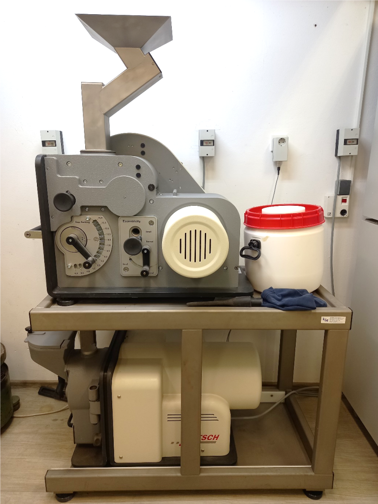
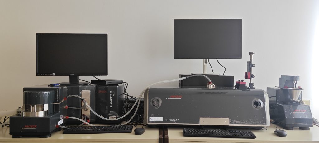
Fritsch Pulverisette 1/13 premium
Description of the equipment
The extremely powerful and compact FRITSCH jaw crusher PULVERISETTE 1 with its drive power of up to 3 kW provides extremely high throughput and is the ideal instrument for fast and efficient primary crushing. Operation: the sample is crushed vigorously in the jaw crusher under high pressure between one fixed and one movable crushing jaw in a closed chamber. It allows for the grinding of hard or very hard, brittle materials up to the hardest iron alloys! The freely accessible crushing chamber and the smooth surfaces in the crushing chamber allow easy cleaning and prevent sample cross-contamination. A Plexiglas cover allows visual inspection of the crushing chamber and monitoring of the action. The slit, which determines the final granularity of the sample, can be determined externally with millimetre precision.
Access to equipment
Analyses for external clients are performed by trained and experienced GeoZS operators upon prior agreement and at times agreed with the person responsible for the equipment.
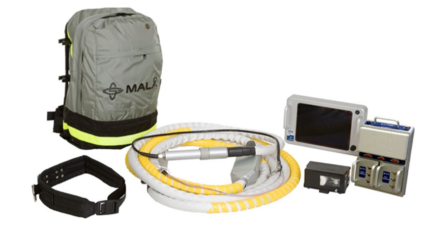
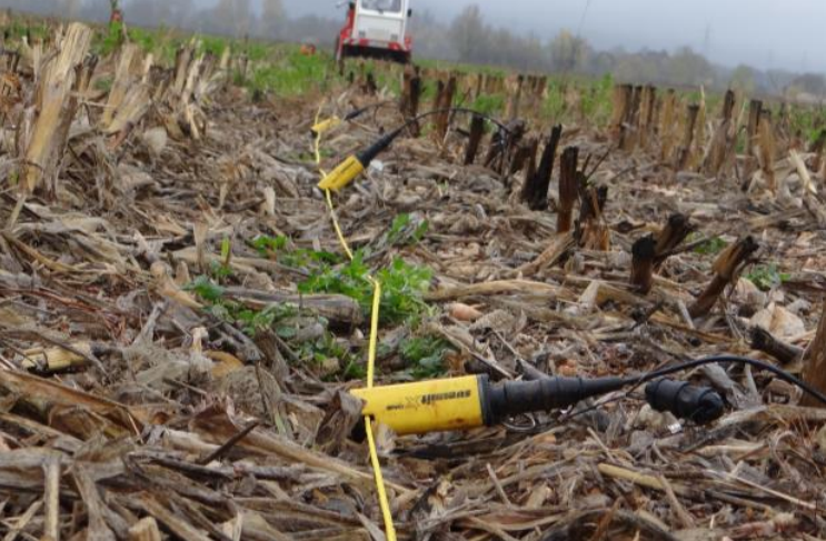
System for Ground penetrating radar (GPR) measurements
Description of the equipment
Georadar is a non-invasive geophysical method that uses antennas of different frequencies to determine the presence of geological structures and other discontinuities in the shallow subsurface, and to track them continuously in space. The lightweight and mobile equipment allows fast and easy acquisition of field data, which is crucial in areas where other surveys are not possible due to access difficulties or the sheltered nature of the area. The GPR can thus provide information on the presence of fractures, fault zones, rock layering, karst caves and other openings, soil moisture and gases, as well as depth to groundwater, landslide slides, the thickness and properties of individual soil horizons and layers, and can also locate various buried objects and possible burrowing.
Due to its versatility, high efficiency and non-destructive nature, the use of GPR for subsurface exploration is rapidly expanding, but a wider range of antennas at different frequencies is necessary to make the best use of the GPR method and its applicability. The higher the frequency of the antenna used, the lower the depth range and the better the resolution of the results. Antennas of higher frequencies (250 MHz, 500 MHz, 1.2 GHz) thus have a lower depth range and provide better resolution of the results, and are therefore suitable for use in the search and investigation of phenomena of smaller dimensions shallower below the surface (search for pipes and cables, inspection of roads and concrete structures, determination of soil properties of agricultural areas, etc.). On the other hand, lower frequency antennas (30 MHz, 100 MHz) allow a deeper reach, which is particularly useful for investigating regional and local geological features of the subsurface. They can provide information on the presence and spatial orientation of various types of discontinuities which, among other things, influence the formation and stability of the surface, condition the hydrogeological dynamics of aquifers, limit the reserves of quarry material in quarries and provide information on the spatial extent of individual stratigraphic members and subterranean karst phenomena.
The depth range and resolution of the results also depend to a large extent on the natural conditions - the properties of the material in which the electromagnetic waves travel and the amount of water and clay fraction present, which causes increased attenuation of the signal. Consequently, before starting a GPR survey, it is necessary to study the measurement area and select suitable antennas based on the desired depth range. The deepest range is provided by the 30 MHz RTA antenna, which is also the lowest frequency allowed for GPR measurements in Europe. Under good conditions, it can reach depths of up to 60 m, with a theoretical resolution of about 1.5 m. As the frequency increases to 100 MHz, the depth range decreases to around 20 m and the theoretical resolution to around 0.5 m. With a 250 MHz antenna, a depth range of up to about 8 m can be expected with a theoretical resolution of about 0.3 m, and with a 500 MHz antenna, a depth range of up to 4 m with a theoretical resolution of about 0.2 m. However, when using a High Frequency (HF) 1.2 GHz antenna, depths of up to 0.5 m with a theoretical resolution of a few centimetres can be expected, and are therefore also used in surveys of concrete structures for crack detection and analysis of the condition of the reinforcement.
Access to equipment
Analyses for external clients are performed by trained and experienced GeoZS operators upon prior agreement and at times agreed with the person responsible for the equipment.
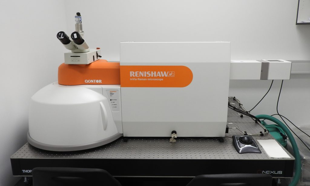
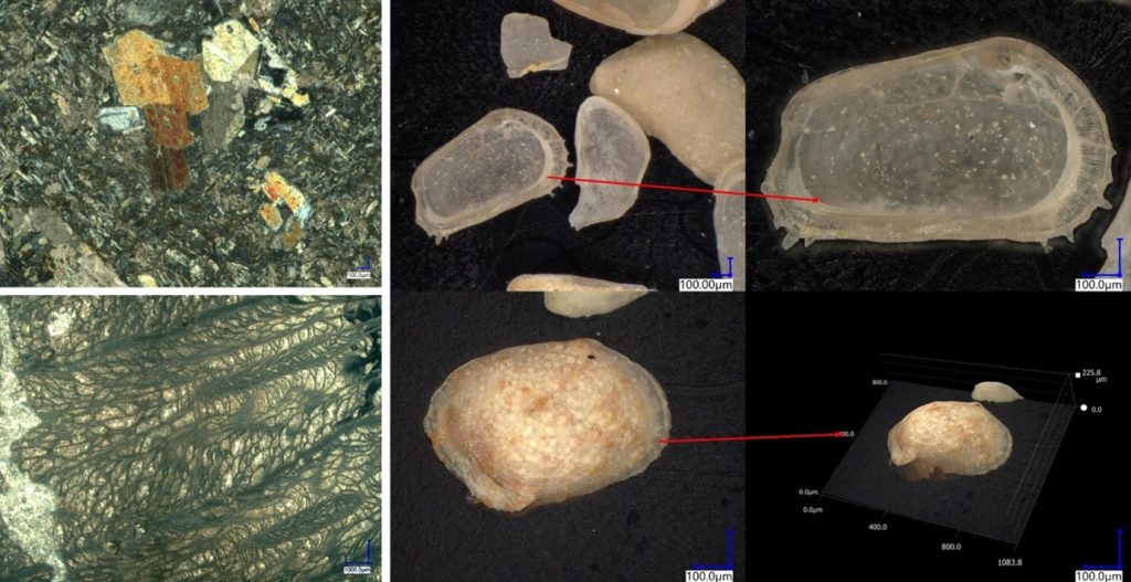
Confocal Raman microscope with interface for in-situ SEM-Raman analysis
Description of equipment
Confocal Raman Microscope is an advanced spectroscopic system designed for high-precision chemical and structural analysis. It is equipped with an interface for in-situ SEM-Raman analysis. which enables simultaneous Raman spectroscopy and scanning electron microscopy (SEM), allowing for correlative analysis of material composition and morphology in real-time
Application
The confocal Raman microscope equipped with an in-situ SEM-Raman interface is a powerful tool for the chemical, mineralogical, and structural characterization of inorganic geological materials, as well as the structural identification of organic materials. Specifically, we use Raman spectroscopy for paleontological investigations, mineralogical analysis of materials, geochemical research on environmental media, and the identification of microplastics in environmental samples
Access to equipment
Analyses for external clients are performed by trained and experienced GeoZS operators upon prior agreement and at times agreed with the person responsible for the equipment.
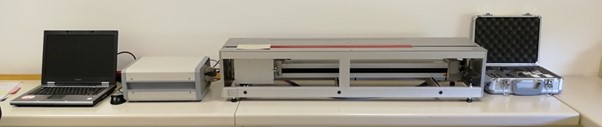
Optical scanning instrument TCS
Description of equipment
Lippmann & Rauen GbR -Measuring range: TC: 0.2 - 25 W/(m∙K), TD: 0.6 - 3.0 mm2/s (TCS - Manual, 31.1.2017)
- Accuracy & precision of results: TC: 3 % (for a confidential probability of 0.95), for TD: 5 %.
- Productivity: up to 60 samples per hour (depending on sample length), if the samples are already properly prepared.
- Sample dimensions: 40 to ca 500 mm with any given shape, where the scanned surface must not have a roughness greater than ± 0.5 mm.
- Maximum scanning length: 620 mm.
- Sample preparation: sawing and polishing of samples is not necessary, if the scanned surface meets the roughness criteria. It si necessary to pre-paint the sample along the scanning line on a flat surface or on a cylindrical surface (with black acrylic paint, thickness 25-40 μm and a line width of at least 20 mm).
- TCS program: control program with an intuitive user interface.
- Scanning speed: 5 mm/s.
- Dimensions: length = 116 cm, height = 24 cm, width = 29 cm.
- Temperature range of use: room temperature.
Note: the meter is suitable for solid rocks, conditionally also for hardened soils and other solid substances, where thermal conductivity is expected within the measuring range.
Application
Project GRETA. Performing measurements of various rock samples for the needs of updating the Geothermal Base.
JANŽA, M. et al., 2017. [Research of the geological and geothermal conditions for the assessment of the shallow geothermal potential in the area of Ljubljana, Slovenia](http://www.geologija-revija.si/dokument.aspx?id=1320). Geologija, 60/2, 309-327. - RAJVER, Dušan, ADRINEK, Simona. Overview of the thermal properties of rocks and sediments in Slovenia. Geologija. [2023, vol. 66, no. 1, pp. 125-150, illus. ISSN 0016-7789. https://www.geologija-revija.si/index.php/geologija/article/view/1852/1929.
Access to equipment
We can perform measurements on samples in the GeoZS geothermal laboratory.