Geological map of the Idrija - Cerkno territory between Stopnik and Rovte 1:25.000
Price: 30,00 EUR
In 1969, the geologist Ivan Mlakar published a paper in the journal Geologija entitled "The Structure of the Idrija-Žiri Territory". This theasis is a fundamental work on the geological structure of the Idrija-Cerkno and Rovte hills, and also explains the natural structure of western Slovenia. The geological map of the Idrija-Cerkno hills between Stopnik and Rovte at a scale of 1:25,000 is based on the results of Mlakar's mapping in the 1960s and 1970s, with additions and extensions of younger mapping. In 2006 and 2007, some areas that had not been subject to detailed geological surveys in the past, or where the conditions had not been satisfactorily clarified, were mapped for the new 1:5,000 scale map. The map is drawn at a scale of 1:25,000 and is of a lithological-structural nature. Another novelty of the map is the use of thrusts to show the spatial position of the strata. The map is accompanied by a comprehensive monograph on the geological structure of the Idrija-Cerkno hills.
Authors: Ivan Mlakar and Jože Čar
Year of publication: 2009, 2010
ISBN 978-961-6498-16-6 (map)
ISBN 978-961-6498-21-0 (monograph)
Send your enquiry
Other publications
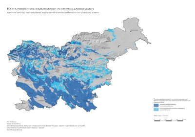
Map of the surface distribution and degree of vegetation of karst areas in Slovenia 1 : 250,000
Price: 25,00 EUR Approximately 98 % of drinking water in ...
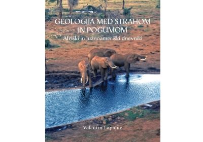
Geology between fear and courage - African and South American diaries
Price: 15,00 EUR Author. Flight ...
