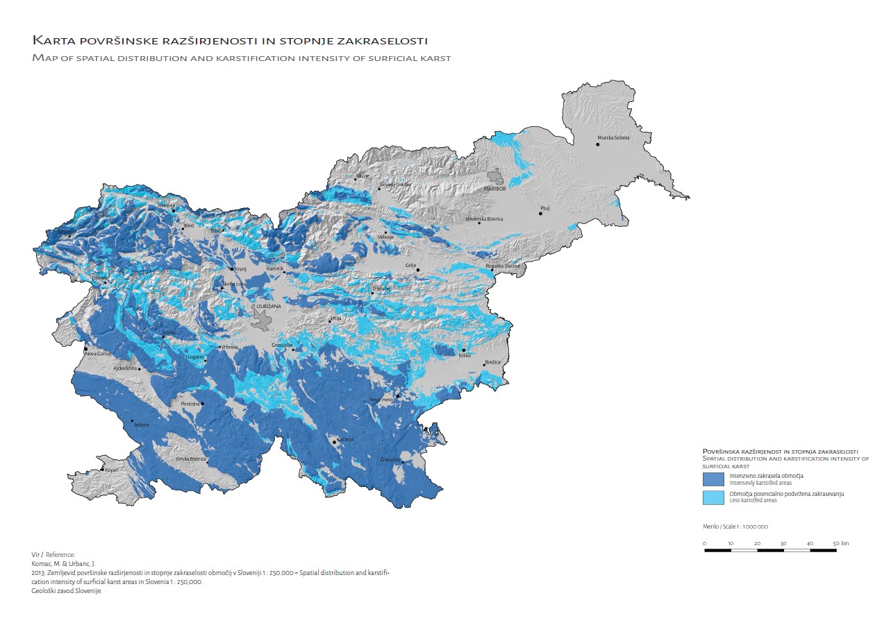
Map of the surface distribution and degree of vegetation of karst areas in Slovenia 1 : 250,000

Price: 25,00 EUR

About 98 % of drinking water in Slovenia comes from underground sources. 42 % of all protected water sources and 53 % of all water protection areas in Slovenia are located in karst areas. Karst areas have specific hydrodynamic characteristics, which are important for the management of karst water resources. A reliable map of karst areas in Slovenia therefore forms the basis for most further steps and activities related to the management of groundwater bodies and water resources, such as the determination of the hydrogeochemical characteristics of aquifers, the determination of the degree of vulnerability of groundwater, or as an aid to the spatial location of environmentally problematic facilities. The content of the map is explained in more detail in the accompanying interpretation.

The study, which was the basis for the production of the Map of Surface Distribution and Degree of Shrub Cover of Karst Areas in Slovenia at a scale of 1 : 250,000, was carried out within the project J1-2349 - Spatial Model of the Hydrochemical Composition of Groundwater in Slovenia in a GIS Environment and was funded by the ARRS and the Geological Survey of Slovenia.

The card is accompanied by an interpreter in Slovenian and English.

Authors Marko Komac & Janko Urbanc

Year of publication: 2013 (map), 2017 (interpreter)

ISBN 978-961-6498-40-1 (card)

ISBN 978-961-6498-54-8 (interpreter)

Send your enquiry

Please enable JavaScript in your browser to complete this form.